Birding Cooloola Mountains To Shore
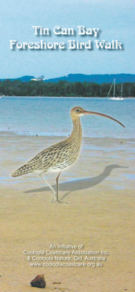
"Tin Can Bay Foreshore Bird Walk"
Along the "Bird Trails of Cooloola"
Welcome to Tin Can Bay & our Wonderful Foreshore!
Not only is Tin Can Bay known throughout Australia as one of the most charming villages on the SE Queensland coast, but our Foreshore
continues to gather praise for it's wealth of natural beauty.
Being located within Queensland’s Great Sandy Straits, it is also part of a Ramsar Wetland of international importance.
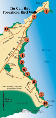
Whether bicycle riding, jogging, or just casually strolling, follow the signage along the 4 km stretch of the easily accessible
“Tin Can Bay Foreshore Bird Walk”; you will soon discover that Tin Can Bay is home to a truly wonderful variety of birds.
With a list of 143 species already sighted, our Foreshore is gaining a “reputation” as a great place to bird watch, providing a range of habitats for
an excellent birding experience!
The sandflats and mangroves are a food source for migratory waders and sea birds.
Patches of Wallum heath and sedges provide shelter for ground dwelling and lower storey birds.
Our native vegetation of Wattle, Sheoak and Banksia provide nectar for the middle storey birds, while birds of the upper-storey feed on the blossoms
of the Red River Gums and Bloodwood.
There are also many spots where birds of the “open space” can be observed.
Remember, sandflies and mosquitoes are also a natural part of our environment, so dress appropriately and always protect yourself
against sunburn, especially in the summer.
A pair of binoculars and a good field guide of Australian birds will no doubt enhance your Foreshore walk.
This Webpage will highlight all eleven Sites featured along our “Tin Can Bay Foreshore Bird Walk”,
itself a feature of our wonderful Tin Can Bay Foreshore!
(For Origin of Tin Can Bay Place Name & others, Click on Highlighted Text)
For some History of Tin Can Bay Click here
Wish to visit Tin Can Bay? Click here for a Map
Wish to stay at Tin Can Bay?
(Click on highlighted text below for accommodation options)
Accommodation Tin Can Bay
Tin Can Bay Motel
Tin Can Bay Tourist Park
Ace Caravan Park
Kingfisher Caravan Park
_________________________________________________________________________________________________
To Print Out the Brochure “Tin Can Bay Foreshore Bird Walk” – Click here
Status Key: (As per Booklet) I = Introduced, V = Very Common, C = Common, U = Uncommon, R = Rare, VR = Very Rare,
SM = Summer Migrant, WM = Winter Migrant
Bold* = Scheduled Bird, Endangered Species Protection Act 1992
(Note – Status relates only to relative abundance of species within the Foreshore bounds)
Most birds listed in this Booklet may be viewed in suitable habitat & season anywhere along the Foreshore.
However, the numbered spots have been identified as the most likely place for an observation of the listed species.
If you should sight a bird not on our list, please report it by logging on to our Website at www.birdingcooloola.org.au
or by Email to [email protected]
Your assistance will be greatly appreciated!
To Print Out the Brochure “Birds of Tin Can Bay Foreshore Bird Walk”, providing an up to date listing
of species recorded on our Foreshore, – Click here
Please follow “Birdwatching Ethics” as you enjoy your stay!
Click here to view “The Ethics of Birdwatching”
Click here to view “Your Health & Safety while Birdwatching”
Happy Birding!
__________________________________________________________________________________________________________
It is the wish of the Cooloola Coastcare Association Inc. and of Cooloola Nature to fully acknowledge all the wonderful
contributors who have extended their assistance to the production of the “Tin Can Bay Foreshore Bird Walk” Brochure,
realisation of the Foreshore Bird Walk initiative, & associated Web Page concept.
Through the generous assistance of the many organisations and community volunteers who have seen fit to contribute
their funds, time and efforts to this project, we hope to make it a lasting and beneficial success.
We dedicate this site to all who stand in awe of nature's wonders!
We hope you enjoy your walk!
__________________________________________________________________________________________________________
_________________________________________________________________________________________________________________________________________________________
Credits & Acknowledgements –
Jan Olley – Concept and Project Member, Originator, and Major Contributor to our Project!
Kelvin & Amelia Nielsen – Concept and Project Members (COOLOOLA NATURE)
[email protected] - www.birdingcooloola.org.au
Larry Larstead - Project Member, Concept Design
Michael Lowe - Vegetation Consultant (Cooloola Coastcare) http://www.cooloolacoastcare.org.au/
________________________________________________________________________________________________________
Our special thanks go to the following photographers for permission to reproduce their wonderful bird images -
Val & Brian O'Leary
Robin Hill
Amelia Nielsen
Valdamay Jones
Adam Marlow
Ken Morcom
Kevin Bowring
Matthew Nielsen
Geoff Skoien
Vernon Kretschmann (Birds Queensland)
Vincent Bugeja (Birds Queensland)
Peter Boyd (Birds Queensland)
Wayne Lock (Birds Queensland)
__________________________________________________________________________________________________________
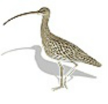
The Eastern Curlew graphic appearing on the linked Tin Can Bay Bird Walk Brochure was reproduced by kind permission of
Graham Pizzey & Frank Knight
'THE GRAHAM PIZZEY & FRANK KNIGHT FIELD GUIDE TO THE BIRDS OF AUSTRALIA',
Harper Collins Publishers http://www.harpercollins.com.au/
__________________________________________________________________________________________________________
The State of Queensland Department of Natural Resources and Mines - for the use of various on-line maps.
__________________________________________________________________________________________________________
The then Cooloola Shire Council - (Now Gympie Regional Council) www.gympie.qld.gov.au for their kind gift of funding
for the printing of the 1st run of Tin Can Bay Foreshore Bird Walk Brochures, and with their generous assistance in the design and printing of the new version of this now available for distribution.
In addition, COOLOOLA NATURE were priviliged to work in association with Gympie Regional Council in a recent upgrade of the Signage along the Tin Can Bay Foreshore Birdwalk. Many thanks to Council for their actions in this regard.
_______________________________________________________________________________________________________
Reference Books sourced -
*THE GRAHAM PIZZEY & FRANK KNIGHT FIELD GUIDE TO THE BIRDS OF AUSTRALIA' -
Harper Collins Publishers http://www.harpercollins.com.au/
* THE FIELD GUIDE TO BIRDS OF AUSTRALIA - SIMPSON and DAY Penguin Books Australia http://www.penguin.com.au/
* Birds of The Sun - Michael Sharland - (Angus & Robertson)
* Bird Wonders of Australia - A. H. Chisholm - (Angus & Robertson)
* The Slater Field Guide to Australian Birds - Peter Slater, Pat Slater, Raoul Slater - (Rigby)
* A Field Guide to the Nests & Eggs of Australian Birds - Gordon Beruldsen - (Rigby)
* What Bird is That - Neville W. Cayley - (Angus & Robertson)
* Field Guide to Australian Birds - Michael Morcombe - (Steve Parish Publishing)
*Discovering Fraser Island & Cooloola, John Sinclair, Australian Environmental Publications
* Reader's Digest Complete Book of Australian Birds, Published by Reader's Digest Services Pty Ltd 1979
__________________________________________________________________________________________________________
Road Conditions – Access to “Tin Can Bay”, (situated in Cooloola, now part of the Gympie Regional Council Local Government Authority area),
is via the well sealed Tin Can Bay Road.
(Click here to refer to Refer Map in “Take the Bird Trails of Cooloola!”)
Cooloola is located just 170 km (or about a 2 hour drive) north of Queensland's major city of Brisbane.
International visitors will find it convenient to fly to the International Airport at Brisbane, then bus or drive to visit our wonderful region.
For a Map of Cooloola (Courtesy of Gympie Regional Council) - Click here
(For Origin of Place Name Cooloola & others, Click on Highlighted Text)
We look forward to seeing you here!
Please drive according to conditions on all “Bird Trails of Cooloola”
For a Digital Map to “Tin Can Bay” – Click Here
_________________________________________________________________________________________________
Welcome to the "Tin Can Bay Foreshore Bird Walk"!
Whether bicycle riding, jogging, or just casually strolling, follow the signage along the
4 km stretch of the easily accessible “Tin Can Bay Foreshore Bird Walk”.
You will soon discover that Tin Can Bay is home to a truly wonderful variety of birds.
With a list of 143 species already sighted, our Foreshore is gaining a “reputation” as a great
place to bird watch!
It provides a range of habitats for an excellent birding experience!
Site Description #1- 25’54.251 S 153’0.892 E
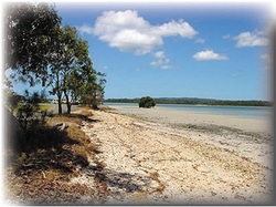
Norman Point is the most north eastern point of the foreshore, and the two small offshore islands (exposed at low tide)
provide a good viewing platform for the observation of Terns and wader birds. The best time to view waders is usually one
hour before or after the high tide. Across the water on the opposite side of the Bay is part of the Great Sandy National Park
and Smoogers Point, a Ramsar listed site and fish habitat, and another good roosting area for viewing waders if you have
access to a boat. Landward, the large 'Native Hibiscus' also known as Cottonwood, with their wide gnarled branches and
heart-shaped leaves provides shelter for Honeyeaters. Around the picnic area is a convenient food source for Sparrows.
For Images & Descriptions of Birds likely to be seen at this Site, click on selected highlighted Text below.
Bar-tailed Godwit
Caspian Tern
Crested Tern
House Sparrow
Pied Oystercatcher
Common Tern
Little Tern
Mangrove Gerygone
Whimbrel
__________________________________________________________________________________________________________
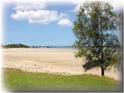
Site Description #2 - 25’54.344 S 153’0.637 E
The foreshore, from the Swimming Pool to the Take-away Shops, has mostly been created from dredge material being
pumped onto the sandflats during the construction of the Fisherman’s Marina in 1998. The wader birds seem to have adopted the sandy beach as a roosting place, and gather here in large numbers, especially an hour or so before the high tide. Look
closely for birds with banded legs and note the colour, this being an indication of where they were banded. Sightings can be reported to the Qld. Wader Study Group on 07 54952758 or at [email protected]. The Cooloola Cyprus Pine (Callitris columellaris) predominates in this area, and is typical of natural foreshore in undisturbed parts of the Inlet. “Cooloola” is an Aboriginal word, said to describe the soft, low mournful wailing sound of the breeze whispering in these pines. Other trees include Blue Gum or Forest Red
Gum (Eucalyptus tereticornis), Lamb’s Tail or Black Wattle (Acacia leiocalyx), and Moreton Bay Fig (Ficus macrophylla). Also, a thick stand of Horse-tail or Coastal Sheoak (Casuarina equisetifolia), which extends onto the sandflats, is the only example of this type of habitat on the foreshore, and is a favourite place for Honeyeaters. Thornbills also prefer this type of habitat. Remember, to observe the open sky at all of the sites.
For Images & Descriptions of Birds likely to be seen at this Site, click on selected highlighted Text below.
Black-faced Cuckoo-shrike
Brown Thornbill
Tree Martin
Red-capped Plover
Great Knot
Lesser Sand Plover
Mangrove Honeyeater
Noisy Friarbird
Red Knot
Red-necked Stint
_________________________________________________________________________________________________________
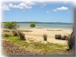
Site Description # 3 – 25’54.752S 153’0.527E
From the take-away shops to Bob Reibel Park is open foreshore with clumps of Blue Gum, Melaleuca (Melaleuca
quinquinervia and Melaleuca viridiflora), and Casuarina trees. The gum trees seem to be the favourite nightly roosting place
of the Rainbow Lorikeets, and especially at this site the screeching can be quite deafening of an afternoon and morning as they come and go. Mistletoe is evident in many of the trees along the foreshore, and prominent along this stretch. Mistletoe is a parasitic plant, obtaining water and nutrient from the host. Interestingly, mistletoe, thought by some to be a European introduced plant, has been part of Australian woodlands and forests since before the break up of Gondwanaland. An article in Birds Australia’s “Wingspan”, (now Birdlife Australia), reported 57 species of birds use mistletoe clumps as nest sites, and the seeds are an exceptionally nutritional food source. The article stated that the proliferation of Mistletoe is probably due to alteration of the ecology, and an indication to the health of the
host tree. Enjoy the spectacular view from the cliffs, which is the only elevation of the foreshore, and a good place to watch for stray ocean birds as well as
raptors and waders. Bee-eaters love to sit on the electricity wires near the cliffs and around Bob Reibel Park, which is a pleasant place for a picnic.
For Images & Descriptions of Birds likely to be seen at this Site, click on selected highlighted Text below.
Australasian Gannet
Blue-faced Honeyeater
Australasian Figbird
Noisy Miner
Rainbow Lorikeet
Scaley-breasted Lorikeet
Striated Pardalote
Welcome Swallow
White-bellied Sea-Eagle
White-throated Needletail
Willie Wagtail
_________________________________________________________________________________________________________
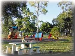
Site Description # 4 – 25’54.979 S 153’0.406 E
This section of the walk is mostly modified foreshore and is allocated as an Intensive Recreational area in the Tin Can Bay Foreshore Management Plan. Tree cover is sparse, with some scattered Blue Gum and Cotton Trees, as well as other planted species, including Slash Pine (Pinus elliotii). The Pine was planted in the 1950/60's, marking the beginning of the Forestry Industry in the region. The Cockatoo's seem to love the fruit, however, the trees are now considered to be an environmental weed, and are slowly being removed from the foreshore. The open grassy areas are favoured by the Plovers, which often nest
in these open spaces. They can be aggressive, diving at intruders if you wander too near their nest site, or their young. The Australasian Pipit, now noted to be declining in numbers throughout Australia, also favour this area, as do the Ibis, especially after rain. The stormwater drain edges, planted by Coastcare in 1997, are starting to attract a variety of Honeyeaters. Waders can be observed feeding on the sandflats at the tide's edge. Swans were once numerous in the Straits, but with declining sea grass, are now only seen occasionally.
For Images & Descriptions of Birds likely to be seen at this Site, click on selected highlighted Text below.
Australian Wood Duck
Black Swan
Channel-billed Cuckoo
Magpie – lark
Masked Lapwing
Australasian Pipit
Silver Gull
Straw-necked Ibis
Sulphur-crested Cockatoo
Torresian Crow
Wedge-tailed Eagle
_________________________________________________________________________________________________________________________________________________________
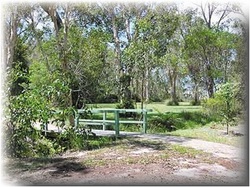
Site Description # 5 – 25’55.178 S 153’0.391 E
The area adjacent to Cooloola Waters Retirement Village is the last good example of natural Wallum Heathland remaining on the foreshore. This remnant area contains patches of Banksia robur, Leptospermums, Pultenaea, and other delicate Wallum wildflowers. Wrens and Honeyeaters are particularly active at this site during the flowering seasons of July, August, and September. "Wallum" is the aboriginal word for the Wallum Banksia (Banksia aemula), and the term is now commonly used
to describe the very diverse coastal vegetation types growing on sand dunes or flat undulating sandy country with low nutrient, acidic soils, and a high water table. Another common feature of Wallum in the Cooloola area is the Scribbly Gum (Eucalyptus racemosa), identified by smooth bark and scribbly tracks made by insect larvae, the only one on the foreshore is at this site. The drainage systems which bound this particular Wallum Heath contains wetland plants, sedges, and ferns, and are good places to observe Rails, Herons and Egrets. The tall Bloodwoods (Eucalyptus intermedia), which many birds are attracted to, start to appear here, and continue diffusely all the way to Crab Creek.
For Images & Descriptions of Birds likely to be seen at this Site, click on selected highlighted Text below.
Black Bittern
Brown Honeyeater
Common Koel
Grey Butcherbird
Nankeen Night Heron
Pacific Baza
Pallid Cuckoo
Pheasant Coucal
Powerful Owl
Red-backed Fairy-wren
Tawny Grassbird
_________________________________________________________________________________________________________________________________________________________
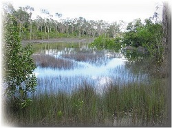
Site Description # 6 – 25’55.159 S 153’0.425 E
Two bollards, on the left over the small footbridge, mark the start of a short mulched track which will take you through a
moist coastal woodland to the fringing mangroves adjoining Site 5. The understorey has been re-generating since 1995, and
the mulched track was the result of a Coastcare Project created by a Green Corp team in 1999. This is a great area for bird watching in all seasons. Butterflies are also very numerous. Both birds and butterflies are particularly attracted to the flowers
of the Pink Euodia or Butterfly tree, (Melicope elleryana), a rainforest species, which flowers in January. Other trees
attracting birds, include Coastal Tea Tree, (Melaleuca quinquinervia), the Casuarinas, Blueberry Ash, (Elaeocarpus
reticulatus), Swamp Banksia, (Banksia robur), Swamp Mahogany or Messmate, (Eucalyptus robusta), and Cabbage Tree Palm, (Livistona australis). The understorey of sedges and ferns, Melastoma, Geebung, the purple Wild Iris, and yellow flowers of the Pultenaea make for an interesting stroll, especially
during wildflower season. The mangroves at the water's edge where the drainage system meets the sandflats are excellent viewing areas for waders, estuarine birds, and kingfishers. On leaving the mulched track and re-joining the path, observe the trees along the path and foreshore edge, as these are also notable habitats for spotting a wide variety of birds.
For Images & Descriptions of Birds likely to be seen at this Site, click on selected highlighted Text below.
Black-winged Stilt
Brush Cuckoo
Forest Kingfisher
Grey Shrike-thrush
Gull-billed Tern
Horsfield’s Bronze-cuckoo
Lewin’s Honeyeater
Little Bronze-cuckoo
Little Shrike-thrush
Olive-backed Oriole
Pacific Black Duck
Rufous Whistler
Sacred Kingfisher
Silvereye
Spangled Drongo
Striated Heron
Varied Triller
White-necked Heron
White-throated Gerygone
White-throated Honeyeater
_________________________________________________________________________________________________________
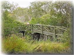
Site Description # 7 -25’55.297 S 153’0.457 E
On leaving Site 6, you will cross over Nola Bale Bridge. This small arched bridge passes over a creek and wetland which is the
end point of a catchment area that drains the perched aquifer system, (see Site 8), running behind the houses on the east
side of the main road into Tin Can Bay. The track leads through modified open woodland, including Melaleucas and Bloodwoods, with vines and Cottonwood fringing the mangrove wetland. Thirteen species of mangrove have been identified
in the Great Sandy Straits, with nine species identified along the foreshore; most common being the Red Mangrove
(Rhizophora stylosa), Grey Mangrove (Avicennia marina), and the Large-leafed Orange Mangrove (Bruguiera gymnorrhiza). Kingfishers feed in the mangroves, and estuarine birds are often seen feeding around mangrove roots and in the shallows. Take a close look in the mangroves facing the Inlet for the Grey-tailed Tattler, who is often perched in the branches at high tide, looking very much like part of the mangrove itself, (September to March). The outer branches of the tall Forest Red Gums (Eucalyptus tereticornis), contain several nests of a long-term resident family of Whistling Kites.
These trees, when mature, also provide excellent hollows for nest sites; Kookaburras and Lorikeets often use them. Doves and Pigeons love to feed on the
ground in this area, and Owls sometimes visit at night.
For Images & Descriptions of Birds likely to be seen at this Site, click on selected highlighted Text below.
Australian King Parrot
Bar-shouldered Dove
Brolga
Buff-banded Rail
Crested Pigeon
Grey Fantail
Grey-tailed Tattler
Intermediate Egret
Laughing Kookaburra
Leaden Flycatcher
Little Egret
Little-Pied Cormorant
Peaceful Dove
Satin Flycatcher
Scarlet Honeyeater
Spotted Turtle-Dove
Tawny Frogmouth
Topknot Pigeon
Whistling Kite
White-faced Heron
Yellow-tailed Black-Cockatoo
__________________________________________________________________________________________________________
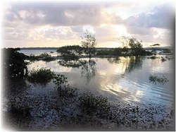
Site Description # 8 -25’55.460 S 153’0.688 E
Tin Can Bay does not have a river system, but is built on what is known as a perched aquifer. This term is used to describe ground water that becomes periodically trapped by restrictive layers of clay or coffee rock, (sand and "cemented" plant matter), that is usually found at depths between of 0.5 to 3 meters. The ground water levels can change according to the amount of rainfall, evaporation rate, and uptake by vegetation. In wet periods, this site usually attracts Spoonbills, Ibis, Egrets and
Herons. Wave action and sand movement creates small dunes at the foreshore edge, which gives long term stability to the coastal system. Associated with the process, a wetland system can sometimes develop behind these dunes. This location
provides a good example of this process, and a variety of wader birds take advantage of the wetland to feed and shelter. Unfortunately, with increase in human activity and uncontrolled dogs, the number of wader birds using this habitat is decreasing. The open woodland area of Blue Gum, Bloodwood, Banksia,
Melaleuca and Cabbage Palms, attract a variety of forest and social birds such as magpies and butcherbirds. Several stumps of dead Pandanus Palms can be
seen at this site, and there are other Pandanus in the process of dying. The dieback is caused by the introduction, from North Queensland to S.E. Queensland,
of the Jamella Leafhopper. As it has no predator in this area, it is feared the moth will totally destroy all the Pandanus Palm on the foreshore, as well as in other areas of the coast.
For Images & Descriptions of Birds likely to be seen at this Site, click on selected highlighted Text below.
Beach Stone-curlew
Brahminy Kite
Dollarbird
Fairy Martin
Little Friarbird
Nankeen Kestrel
Pale-headed Rosella
Red-winged Parrot
Royal Spoonbill
Southern Boobook
Yellow-billed Spoonbill
__________________________________________________________________________________________________________
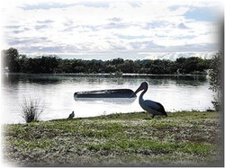
Site Description # 9 -25’55.725 S 153’0.834 E
A small mangrove lined watercourse dissects this site, consisting of a modified melaleuca wetland, swales, and depressions.
The watercourse sometimes produces a sulphur smell, which is believed to be naturally generated by the decay of organic substances. Here Pardalotes have been seen building nests in the banks. Wattlebirds favour the Black Wattle trees and
Banksia at this site. Again, the sandy flats are a good vantage point to view waders, particularly as they feed or gather along
the waters edge at mid to high tide. Oystercatchers and waders, including Golden Plovers and Greenshanks, are often to be
found sheltering behind the line of oyster beds occurring on the sandflats offshore as you look towards Site 8. Silver Gulls, Pelicans, and some birds of prey gather opposite the Wallum garden, associating food with human activities at the nearby shop. Coastcare planted the Wallum garden in 1997; now well established and attracting a wide range of birds including the Double-barred Finch. Note the telephone box; call a taxi if you do
not wish to walk the 4kms back to your car.
For Images & Descriptions of Birds likely to be seen at this Site, click on selected highlighted Text below.
Australian Magpie
Australian Pelican
Common Greenshank
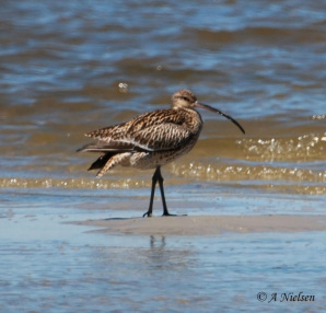
Eastern Curlew
Galah
Grey-crowned Babbler
Little Corella
Marsh Sandpiper
Pacific Golden Plover
Pied Butcherbird
Pied Currawong
White-breasted Woodswallow
__________________________________________________________________________________________________________
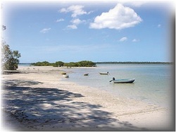
Site Description # 10 -25’55.859 S 153’0.931 E
You have now reached Crab Creek, the end of the 4km TCB Foreshore walk. Re-vegetation of the creek bank was undertaken
by Cooloola Shire Council and the Coastcare Group, commencing in 1996. The native landscape planting and the gums
fringing the creek now attract a number of birds, including Honeyeaters and Mistletoebirds. Keep an eye for Cormorants and waders in the creek, and watch for birds straying into this area from the adjoining natural bushland. Bee-eaters are often seen
making their in-ground nest in these open sandy and slightly sloped places. Behind the mangroves on the opposite bank is a large Ramsar listed wader bird roosting area, while kingfishers and the Shining Flycatcher have been seen in the mangroves.
The large nest visible in the dead tree on the opposite side is an Osprey's nest, sometimes used by the Brahminy Kite.
For Images & Descriptions of Birds likely to be seen at this Site, click on selected highlighted Text below.
Azure Kingfisher
Double-barred Finch
Eastern Whipbird
Eastern Yellow Robin
Great Cormorant
Little Black Cormorant
Little Wattlebird
Mistletoebird
Eastern Osprey
Pied Cormorant
Radjah Shelduck
Rainbow Bee-eater
Restless Flycatcher
Shining Flycatcher
__________________________________________________________________________________________________________
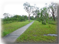
Site Description #11 -25’54.521 S 153’0.096 E
Site 11 is really an entire track, which runs along Snapper Creek on the northwest side of the Inlet. This track can be accessed from two ends, either between Sites 2 & 3 at Oyster Pde near the Marina, or from Toolara Road between Sites 4 & 5, starting behind the Dolphin Shopping Centre. On this walk, you will pass fringing mangroves and salt marshes with large Blue Gums, Casuarinas, Swamp Oak and Melaleuca lining the creek bank between the Marina and Squire Street. The track also passes
an extensive area of re-generating Wallum. A close look at this vegetation type is sure to reward the viewer with an
unquestionable appreciation of its unique diversity and special beauty. You will find colourful sedges, wildflowers of the
coastal heath in shades of blue, mauve, pink, and yellow, ground orchids and shrubs; something is in bloom all year round! Chances are you will see many of
the birds listed along the foreshore, with the possibility of also seeing Quail, Snipe, Rails, Raptors and Wrens. On the other side of Snapper Creek is the
(no-go) Wide Bay Military Training Area. This is a live-fire weapons practice range, but surprisingly, (at least for the past several years), there exists a large
colony of the elusive Ground Parrot. A parrot or two have been known to stray onto our side of the creek, so with Wallum vegetation steadily re-generating into suitable habitat, keep your eyes peeled ........ You never know your luck. HAPPY BIRDING!
For Images & Descriptions of Birds likely to be seen at this Site, click on selected highlighted Text below.
Australian White Ibis
Brown Quail
Collared Kingfisher
Latham’s Snipe
Peregrine Falcon
White-cheeked Honeyeater
_________________________________________________________________________________________________________
